Day 1 upon arriving to Cloudcroft, ate BBQ, drove down FS 90 ultimately camping at Mule Peak 8900ft with an incredible sunset view looking down to Alamogordo, White Sands, and San Andreas Mountains. Nothing gnarly trail wise really, just a bit of 4wd need to get to the old heliport/observatory.
For a kick, you might want to tell family/friend to tune to the Cloudcroft Live Web Cam YouTube channel to catch a glimpse of you... https://www.youtube.com/watch?v=h2b3uGMN6kc
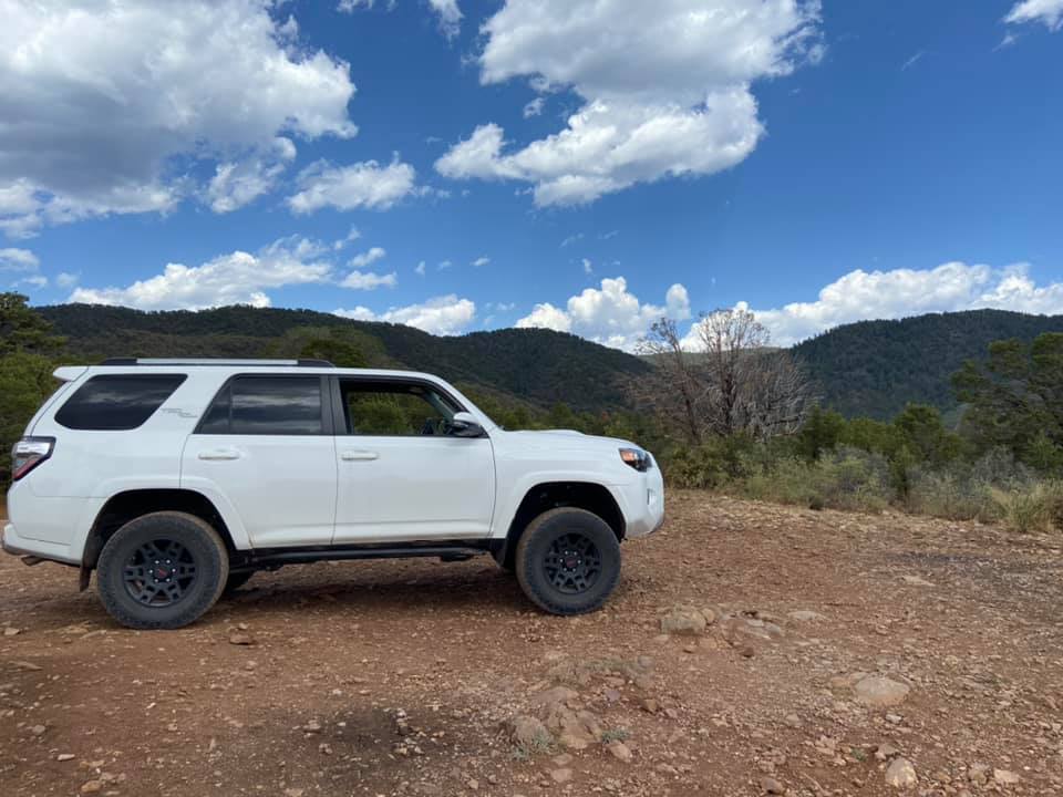
After Cloudcroft lunch we check out the trestle briefly before we headed west out of Cloudcroft on Hwy 82 to High Rolls, where we headed south to Forest Service Road 90. FS 90 is pretty tame, but I recommend airing down to 20-25 for comfort. It's very hardpacked most of the way, with potholes, braking bumps, loose gravel, but nothing technical. It's very scenic and very tempting to stop frequently, as to the west is Alamogordo and White Sands, and across to the San Andreas Mountains which are easily visible.
We decided Mule Peak was our camping spot. We headed out around Mule Peak to Burleson Rdige for our first taste of 4WD in The Sacramento. Nothing crazy, bits of fun and lot's a rock. Before it got dark we set up our hammocks, got camp ready and visited the old observatory/heliport at the top.
Gaia track for Day 1 https://www.gaiagps.com/map/?loc=11.6/-105.8803/32.8712&pubLink=QB6xqw8bCZcXxZ3ZGjDDghzn&trackId=66db1c064dbca71389ca104f60d183d5
Day 2
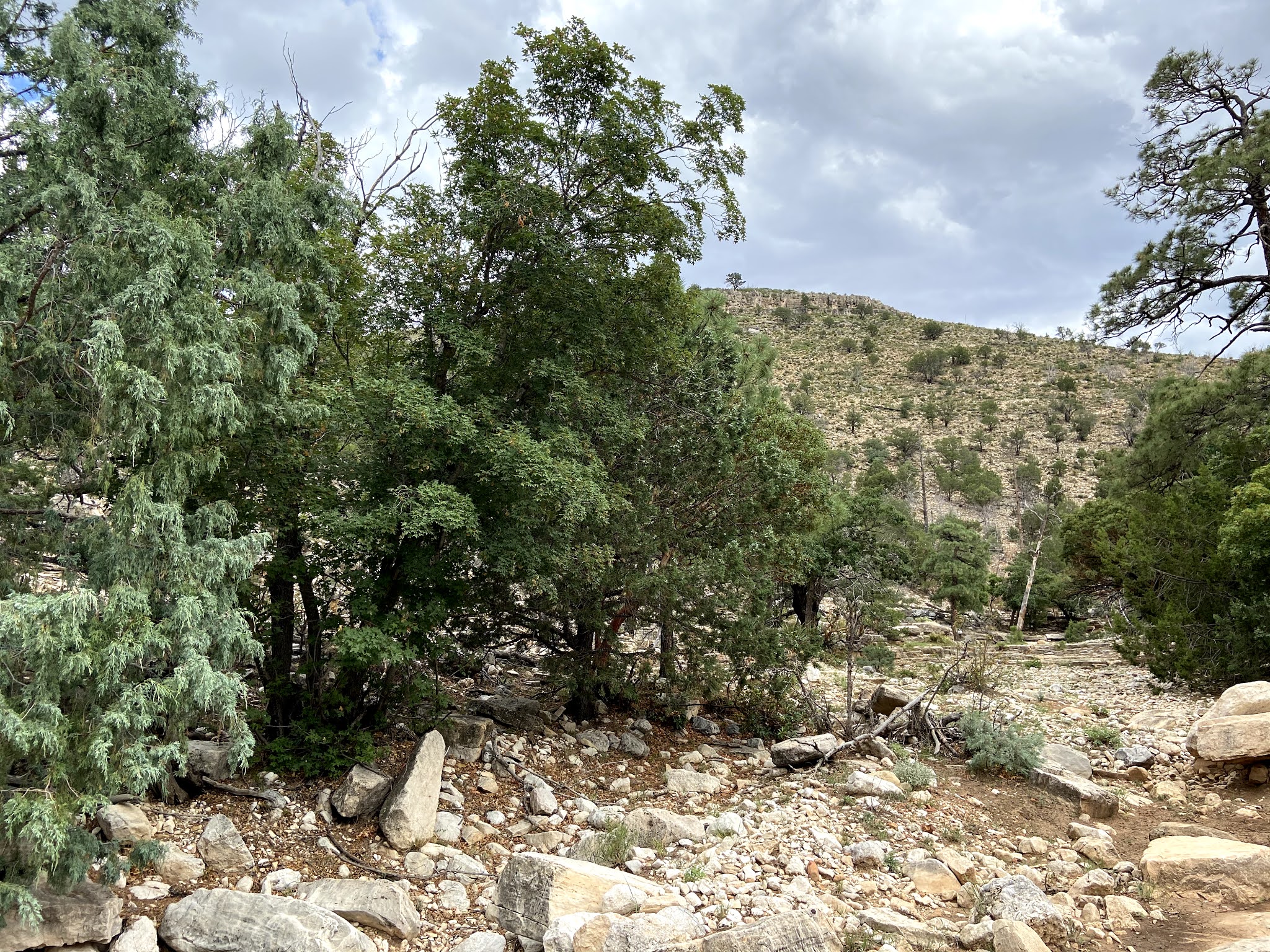
It was a chilly, windy evening on the peak despite the safety of the trees. Not horrible, but chilly. Burritos for breakfast. Then we continued down FS 90 and hit some challenging high clearance 4WD required trails out to Joplin Ridge via FS90B. If you come down FS 90 in a capable vehicle and do not visit Joplin Ridge to the top you have done yourself a disservice! It's a bit challenging, but well worth the views.
Gaia track: https://www.gaiagps.com/map/?loc=12.7/-105.8619/32.8092&pubLink=ZSzbbCgERJuMNgBYEDTGIrAm&trackId=2d5c598a25c5ee52914f962885c79075
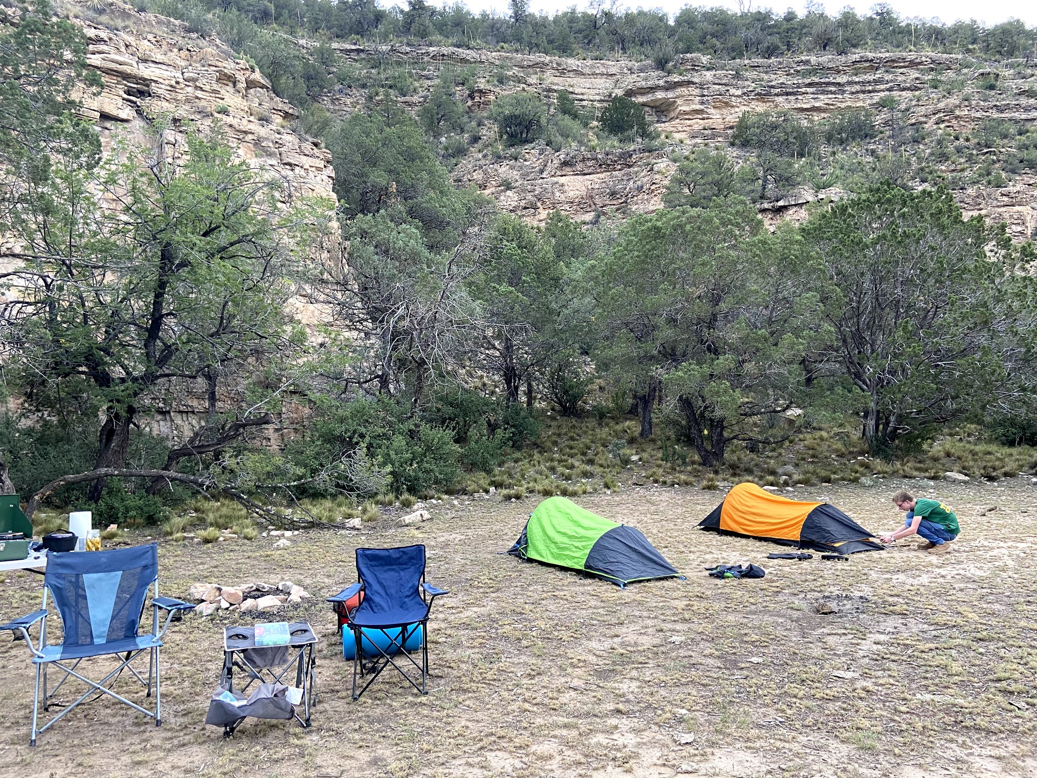
After Joplin Ridge we completed our visit of FS90, headed north up the Sacramento Canyon Road to Bluff Springs. Not Gaia track for this, it's a highway to an obvious, well-mark turn off to Bluff Springs. We visited the waterfall and the spring, then hike a bit of Bluff Springs before heading off to find camp. The goal was to find a nice aspen grove to camp in. As you can see by the tracks we checked out several places before finding the perfect spot high up in the aspens.
Gaia track - note that the track does not lead to the actual camping spot, but the next day starts from there. https://www.gaiagps.com/map/?loc=12.4/-105.7931/32.7649&pubLink=waqp6qArpdojQkGeApBX9Csf&trackId=54fd32c703af95550d52013018ab29f6
Day 3 started incredibly at 6am. I woke to the sound of elk bugling and barking. I could tell it was close. I didn't want to miss it, so off a ran in my thermals and slides. I caught the tail in of the herd crossing an opening and decided to head over the ridge to cut them off to hopefully get a better view. Yes, in thermal underwear and slides I headed over the very steep and rocky ridge... I made it and got some decent video...but the large bull elk evaded me...
The rest of the day was a mix of easy and some moderate off road trails, lots of mileage today. Do yourself a favor and download NFS Visitor maps - they will show springs, mines, caves, ruins, etc that other maps and current park maps may not show, nor will there me signs for. We were able to find 3 springs that were otherwise unmarked. Along with the elk, we say coyote, wild turkeys, and a lot of mule deer today. We did hit a snag on a trail that appeared open, not sure of the official status and Park Rangers have not returned my call. Forest Road 564 is gated and locked with no trespassing signs. I am used to seeing gates and signs, but knowing the MVUM is the rule I open drive thru and close, ignoring the incorrect signage, but this was locked and the status was questionable, so we turned around.


Later in the day we hit the trails right outside of Cloudcroft just to the SE, we took 130 to FS5661, it's an out and back, we considered camping along it for our last night, but instead we explore a couple of the trail offshoots. We decided to spend or last night a bit on the way home, so we gassed up and headed east down 82 to Three Mile Canyon, FS 0228. It was a very hot evening and we thought sleeping way "down here" at 7200 ft would make for a much warmer night than the rest...again, it was a very hot evening... woah boy...I slept in brief, no shirt and didn't bring my bag into the hammock... I woke at 4am and check the temp ... 48 degrees. I was too stubborn and tired to do anything more than put my North Face fleece button up camp shirt on and stick it out for another 2 hours before we really woke up. Gavin and I sat in the truck with the heater blasting for about 20 minutes before we were warm enough to break camp. This was our first time hammock camping, it will not be our last. Underquilts are on the wish list and I imagine we would have had little to no discomfort with them.
We headed home and ate in Big Spring at Big John’s Feed Lot by Brenda, highly recommended if you love meat, huge servings, and very dated decor.
Day 3 tracks:
https://www.gaiagps.com/map/?loc=12.7/-105.7309/32.7751&pubLink=es1cMgo90EIAqLNsMnQtExeu&trackId=7a1e27c1cc5de98f32bf6773e074c6e7
https://www.gaiagps.com/map/?loc=12.7/-105.7309/32.7751&pubLink=DfZ3zpNjp9lqUiwpmidGGixH&trackId=ce3e94045c56b98498fff02672cafd64
https://www.gaiagps.com/map/?loc=13.2/-105.7111/32.9338&pubLink=rQZlE6Mu4YhazUnSElo1l6eb&trackId=9126bfbedbbfd987c0963fac430d5d57
https://www.gaiagps.com/map/?loc=14.6/-105.5495/32.9184&pubLink=9st6fYSyeoRzFfrxdg8sfQVg&trackId=fb42b1aeec0f2fa8d93686ed6fc5021e
Miscellaneous
Food - we keep it pretty simple and generally have the same thing each day. I switched from a large old liquid fuel 3-burner coleman stove to a smaller, "suitcase" style coleman propane grill. I found a cast iron skillet/grill (flat on one side, grill ribs on the other) that fits it perfectly (even packs away in it close) at Big Lots for $10. We don't have fridge/freezer yet, but Yeti/Rtic coolers work fine for up to 5 day trips (use freezer blocks along with ice).
I use snap lock containers for most things, I unpackage to make things fit easier, require less prep, and minimize trash. These are airtight and watertight (ziploc are NOT) and stackable. Eggs go into blenders bottles since they will be scrambled. You can fit a dozen larger eggs and 200 grams of egg whites with room for shaking in a 28oz BB.
Breakfast - burritos full of turkey sausage (or Slovacek's), potatoes, peppers, onions, eggs, cheese with a banana.
Lunch ham and cheese sandwiches with fruit (grapes and berries are typical) with HEB thin chips - I like the Jalapeño Queso, Gavin prefers the Sour Cream & Onion
Dinner - Slovacek's sausage wraps or on bolillos, occasionally I'll bring ribeye along for a real treat, but that's usually during hunting trips.
PSA: This is why we cut our mud flaps... no real damage here except a few of the mud flap clips, the rear popped right back in.